This article is a little bit misleading, unless I am misinterpreting his pictures. But that would be horrible for an article trying to explain pictures.
Now note the image that the article depicts for Hurricane Irma with this text:
"These misunderstandings have real-world consequences. As Hurricane Irma approached Florida’s east coast in 2017, people near the cone’s center began preparing and even evacuating."
The image and the graphical archive do not correlate. Where did the author get this image from? The actual NHC cone covers the entire width of Florida (apart from maybe the smallest western tip of the keys) for days before the storm arrives. Its actually pretty accurate.
IMO, this article and its poor visualizations is part of the problem.
Hi Jsight, Alberto Cairo here. I wrote the piece, but didn't design the maps, so I'll ask.
In any case, even if there's an inconsistency between the maps in the piece—which are intended to be illustrative, I guess—and the NHC ones, it doesn't undermine, I think, the overall message, which is that, regardless of whether you are inside of the cone or outside and close to it, it's safer to prepare just in case.
People should pay less attention to the center dots or line of the cone (many do that) and focus more on facts such as that (a) the cone is essentially tons of possible positions of the center of the storm in the next few days, (b) the storm may end up going outside of the cone 1/3 of the time (so I'd say it doesn't matter much that, say, Naples is outside of the cone, but very close to it on the map.)
I've been in Miami since 2012 and lived through Irma, so I remember what I wrote in the piece well. When the central line of the cone was running over Miami, people over here got crazy, and people on the West coast of Florida were watchful, but a bit less concerned (there's a link to an LATimes article in the piece that describes that), again likely because some folks tend to focus too much on the center line and dots inside the cone. There's tons of evidence for this kind of misinterpretation (one academic paper is linked from the piece).
The piece was reviewed by scientists at UM's School of Marine and Atmospheric Sciences; I won't say it's 100% correct, but I'm relatively confident the description, albeit simplified (I didn't explain what that "uncertainty" is for, instance!), is sound.
Truly nice of you to comment but did you not review the graphics and the source of them to make sure they matched your narrative? Seems important considering it is a piece about graphics and interpretation.
Again appreciate you taking the time to join the discussion.
Having been raised in Florida, you live through so many which are hyped up and so many of them end up missing or diverting away from the state altogether that people get cocky about it. Getting hit by the eye of the hurricane is much different than getting hit by the outer bands or even the middle core of it. The strongest winds are near the eye. The rest of the storm can still do rain and wind damage but it's nowhere near as bad, so it's easy to fall in to false sense of security. That being said, it's also easy to over-worry.
Having lived in Florida for many year, I'll say hurricanes are terribly destructive but in most* cases, the risk to humans is minimal. Stay in your house (unless it's a prefab), or go down the local shelter.
The worst parts of a hurricane are property damage, lost power, no gas, etc. It's much different than a wildfire or a tornado.
Call me an idiot, but risk vs reward...I'm gonna stay put. I've saved thousands in property damage that way too.
---
* If you build a city below sea level, that can turn out pretty bad. Also, if you are in poor health, live directly on the beach, or live somewhere without shelters or robust infrastructure.
Risks are higher at the center of the cone. A hypothetical 100 mile wide storm that’s 40 miles west of the centerline still covers the centerline, but likely misses the eastern edge.
Also, staggered evacuation is a good thing, you don’t want everyone in a city to decide to leave at the same time.
That might be true mathematically but talking to forecasters who work on this, they greatly de-emphasize the center line. Instead, they do emphasize that the forecast is the cone, not the center line alone. They direct your attention away from the center line (readers tend to stick too much to it), and say something similar to what is in the article: areas outside will be likely affected, everyone should take precautions and prepare regardless of where we are — and we should read other graphics and messages that can tell us, for instance, whether there may be storm surge, flooding, or whether we need to evacuate or not; the cone tells us nothing about any of that.
One last thing: risks aren't necessarily higher on the center line. Just to give you an example: if you live in a low-level region far from the center line but that is prone to flooding, risks may be higher than if you are by the line but your house is on high ground (again, the cone says nothing about hazards, as pointed out).
The general problem that the article raises is still valid even though the pictures don’t match.
The article is pointing out that the increasing circle sizes represent variation of centerline paths, not the actual size of the hurricane (which is a common misconception). Just because the plots don’t match doesn’t make the article irrelevant.
I get your point, but there is another angle here. People have a strong tendency not to trust forecasters, despite relative accuracy. This article implies a lack of accuracy that wasn't actually the case.
It would be incredibly easy to come away from this article with the wrong lessons.
Where do you see the article implying the forecast was inaccurate? To me the author is only saying that how people interpret it is inaccurate which is the entire point of the article.
Yes, exactly. The cone is as accurate as it can be, by which I mean: accurate but with a huge degree of uncertainty. The challenge is that some readers tend to read it as deterministic, and get it wrong by:
1. Thinking "If I'm inside of the cone I'm in danger, if I'm outside I'm good" (wrong! 1/3 of the time the storm will be outside of the cone!)
2. If I'm inside of the cone AND under its center line/dots of I'll worry a lot, but if I'm inside and in between the center of the cone and its boundary, I can relax (I'd be VERY careful with this, as it isn't true either).
And your article drives this point home really well. I honestly don't understand the criticism - the hurricane example you picked from 2017 is just to make a point - which people in this thread are unnecessarily complaining about.
> People have a strong tendency not to trust forecasters
It's possible a lot of this bias is just outdated, up until very recently most hurricane (cyclone in my case) warnings came with a disclaimer like "cyclones or notoriously unpredictable and can make sudden, unexpected course changes" and for the most part this was true even in the short term. I don't think I've seen a wildly incorrect forecast in my area in 20 years but my mother still believes in this inherent unpredictability.
The challenge is that, eventually, the forecast of one storm will be wildly off. This is inevitable. But that doesn't mean that the forecast was necessarily incorrect. I think that this is what it's crucial to explain to the public: the general meaning of uncertainty. We need to learn to deal with it.
Why use a real-world example if it's not going to be based on data? Surely if the numbers are correct that there's 60-70% accuracy with the cone (on any particular day? or possibly early on) then they could use real data.
It also starts with "The National Hurricane Center publishes graphics like this one" (with "graphics" directly linking to a different graph than the one shown [1]) which would lead one to believe it was an actual NHC example being challenged.
The general point can still get across but its just important to choose your anecdotes carefully if you want to be taken seriously.
Especially in the hyper-critical social media age when everyone is looking to kick anything popular down a peg or two, for their own personal satisfaction of being smart (or w/e the motivation is).
This is extreme. Why use a real-world example? Because people can relate to it. People have seen these types of plots. It could have been a completely fabricated example of an arbitrary hurricane in Florida or Canada or whatever - the point would still be the same. I feel like people are completely missing the point of the article.
Also, my question is : what are the wrong lessons that this article teaches?
A whole lot of people who are the target market for this article would likely have experienced the same hurricane. Not giving the peanut gallery easy reasons for dismissal is something to be considered.
> Surely if the numbers are correct that there's 60-70% accuracy with the cone (on any particular day? or possibly early on) then they could use real data.
I've noticed this as well. In reality, outside the cone seems to happen pretty regularly. So far outside the cone that it is significant as a practical matter is much more rare, at least in terms of the 48 hour cone.
> Especially in the hyper-critical social media age when everyone is looking to kick anything popular down a peg or two, for their own personal satisfaction of being smart
NHC tropical cyclone forecast tracks can be in error. This forecast uncertainty is conveyed by the track forecast "cone", the solid white and stippled white areas in the graphic. The solid white area depicts the track forecast uncertainty for days 1-3 of the forecast, while the stippled area depicts the uncertainty on days 4-5. Historical data indicate that the entire 5-day path of the center of the tropical cyclone will remain within the cone about 60-70% of the time. To form the cone, a set of imaginary circles are placed along the forecast track at the 12, 24, 36, 48, 72, 96, and 120 h positions, where the size of each circle is set so that it encloses 67% of the previous five years official forecast errors. The cone is then formed by smoothly connecting the area swept out by the set of circles.
It is also important to realize that a tropical cyclone is not a point. Their effects can span many hundreds of miles from the center. The area experiencing hurricane force (one-minute average wind speeds of at least 74 mph) and tropical storm force (one-minute average wind speeds of 39-73 mph) winds can extend well beyond the white areas shown enclosing the most likely track area of the center. The distribution of hurricane and tropical storm force winds in this tropical cyclone can be seen in the Wind History graphic linked above.
Considering the combined forecast uncertainties in track, intensity, and size, the chances that any particular location will experience winds of 34 kt (tropical storm force), 50 kt, or 64 kt (hurricane force) from this tropical cyclone are presented in tabular form for selected locations and forecast positions. This information is also presented in graphical form for the 34 kt, 50 kt, and 64 kt thresholds.
The article is trying to explain what a confidence interval is. I think it does a good job and connecting it with real world consequence of where statistical representations and interpretation lead to people being complacent about risks.
"The National Hurricane Center says cones will contain the path of the storm center only 60 to 70 percent of the time"
Sounds like the communications fix is easy. Increase the uncertainty to 90-95% which also increases the cone size. And make it blood red and tell anyone inside the red that they need to be prepared.
"Hurricanes are also hundreds of miles wide, and the cone shows only the possible path of the storm’s center"
Add an additional yellow area around it. This makes it extra clear visually that the red zone is quite bad.
Right. Some of the "popular interpretations" dismissed in the article are correct, or wrong only in degree rather than in kind. Your home is more in danger inside the cone than out of it, and it is more in danger at the centre of the projected path than at the fringes of the cone.
If the problem is that people with a low to moderate risk of losing their home or their lives don't prepare enough, then yeah, show a wider area, or the two-level nuance of "red threat" and "yellow threat". And balance it against the inevitable "well, the last four times the government said there was a storm threat it didn't come near here, hell, the last time it made landfall 400 miles away".
But probably is not intensity.
Half chance of full intensity doesn't mean full chance of half intensity. If you'd evacuate the red zone but not the yellow understand, do you really understand the bet you are making?
I've been living with hurricanes my entire life, and have been through many (the largest was Hugo in '89). The problem with all these cones is when they extend them beyond 72 hours. At that point, if we used your suggestion, the entire east coast could be in the cone. That means either no one pays attention, or everyone evacuates and next time ignores the warnings.
What officials (and the news) need to do is tell everyone to hold tight until 3 days out, and then start making decisions.
People also need to understand their personal situation. If an area floods during a summer rain storm or simply when the tide is high, then they need to be extra cautious.
The other problem is that many people simply have no idea what it's like to go through a hurricane. The mass migration to the coast means large parts of the population do not have the experience to make informed decisions. This goes back that officials and the news need to do a better job at informing.
My personal rule to consider evacuating is a cat 4+ predicted direct hit or just south and it is less than 48 hours out.
> My personal rule to consider evacuating is a cat 4+
As you know well having lived through Hugo, the S/S category pertains to the wind speed. However, it's the flooding and storm surge, not the wind, that are by far the most deadly features of a hurricane.
I'd be much more wary of a big, slow moving cat 2 arriving right at high tide and full moon than I would be a small, fast moving cat 4 arriving at low tide and a new moon, unless I have some particular reason to fear the wind and not the water (eg I'm in a mobile home on high ground).
Source: lived through or evacuated for multiple hurricanes.
Note for the record that large tides (spring tides) are associated with full moon and new moon. Smaller tides (neap tides) are associated with half moons.
I feel like the news and government response has been to very strongly err on the side of caution lately. The moment the path was updated to move to a direct hit of north Florida yesterday, grocery stores and gas stations were flooded with people preparing a week in advance. 10 or 15 years ago you'd hear a lot of "well a storm hasn't hit here in 100 years" in the region, but nobody fucks around like that anymore.
You have to balance it with they crying wolf problem. If you make the cone too big, every hurricane will trigger a warning and then people will ignore it if the hurricane keeps missing them.
I think that would be a pretty big cone. You might end up with the situation where nobody takes it seriously - "oh I was in the last 5 cones this year and didn't get a single drop of rain" type of attitude.
Florida native and I've live here all my life. If you're within the radius of hurricane force winds, live near the coast, live in a flood prone area, live in a shed, live in a trailer, you should take these storms seriously. If you're inland, and not in a shed or trailer, you should be fine if you don't do something stupid, like stand outside. Don't go out and hurricanes are rarely more than a nuisance to those inland.
This is a compact storm; it's HFW extend out 15 miles. Anyone outside of that and not on the coast isn't going to have much to worry about.
Exactly. I made a comment above that mentioned the mass migration to the coasts means that many people do not have years of experience dealing with hurricanes. What you just said is common sense for you and I, but may be a complete unknown to someone who just moved from NJ or Ohio.
I moved to Florida from Sweden 1.5y ago. The most extreme weather preparations I've done in the past were putting the garden furniture in the garage so it wouldn't tip over.
That won't fix the problem. The NHC uses an ocean model, but the transition across Florida requires the application of a hybrid land/water model, which results in a large divergence when the results of the different models are combined. Fortunately, someone from Mississippi State University developed such a model in 2004. It successfully predicted the exact path of Hurricane Katrina over a week in advance of landfall. That weather model is used for XM Sattelite Weather and the Gulf Coast Hurricane Index, but the NHC still hasn't adopted it after 15 years.
I’ve only had to deal with one hurricane personally (Irma), and the forecast cone was only useful as an indicator to pay attention to the other, more detailed forecasts. As far as I’m concerned, it’s a relic from when weather forecasting models were much more primitive and graphics had to be reducible to B+W for printing.
people are really bad at understanding probabilities. just look at people's interpretations of polling analysis before the 2016 election. or people's complaints of missing 95% shots in xcom.
I grew up in South Florida, and I'm surprised to hear people think the storm is getting bigger over time. I guess that's just something you grow up with knowing down there. People on the west coast tell me they're terrified of hurricanes, and I'm terrified of earthquakes. You can generally get out of the way of a hurricane if you feel you need to...
There are of course common sense things to do to be prepared: get bottled water, food, fill your bathtubs with water and a drop of bleach, make sure the car has a full tank of gas. We personally brought my grandparents down from Boca to stay with us. You can do those maybe a week, 4 days out before stores start to get really empty (grandparents can be moved earlier or later). If you have any coconuts palm trees, chop down your coconuts. These are common sense things to do if there's a remote possibility of a tropical storm or hurricane coming your way.
But I do think it's a little disingenuous to say that people didn't do enough to prepare if they lived on the west coast, given how quickly the path shifted. Partly because the NHC is generally so good at their predictions. If you saw the earlier map that had Irma going up east coast, and you were in Naples, you wouldn't think about moving, or at least I wouldn't. Our buildings, especially the newer ones, are built to withstand at least some level of wind. My house built in the 90s has held up through multiple Category 3s (Charlie and Wilma). It's of course all luck, and I know plenty of other houses that have had damage, parts of the roof torn off, shattered windows, though nothing catastrophic, built around the same time. I've driven through the outer bands of a tropical storm (not that you should, but I was in high school and we had a back to school party the night before, and I wanted the car to be home).
That's not to disparage the work of the NHC. They're great at what they do, and I read pretty much every advisory for every hurricane that's in the Atlantic. When you've got no place to go, a hurricane bearing down on you is a very scary thing. But if I'm in Naples, and 4 days out it looks like it's heading towards Ft. Lauderdale? I'm not making plans to move.
Thank you. I will say that we are relatively lucky in that we live inland, so we didn't have to worry about storm surge, in a newer suburb that had its power lines underground. We maybe lost 20 minutes of power during Wilma. I have family that lives in East Ft. Lauderdale, they were out of power for two weeks.
Wasn't alive for this one, but this was one that my parents got out of the way for. With the forecast shifting south every day, I have a sneaking feeling this could be another one they get out of the way for. The problem with Dorian is it looks like it's going to hit south, and then move up the state. Nowhere really to go.
For this exact reason, the image of the cone on the NHC website [0] has the following disclaimer on the top:
"Note: The cone contains the probable path of the storm center but does not show the size of the storm. Hazardous conditions can occur outside of the cone."
But apparently media organisations repost that image without the added disclaimer.
I live in a hurricane area. We don't use the news for any information other than watching the weatherman stand in the storm and film, and satellite imagery while it's going on. We use noaa.gov, it has all those prediction maps. It's very good.
For those that haven't been through these, the predictions do shift up to the last minute, so we'll check the maps every few hours just to see where it's headed. They update more frequently the closer it gets. Dorian's path seems to have moved a little south since this morning. Also, most areas aren't what you see on the news; they like to show the exception areas as the norm (shocker).
I "still" live in a hurricane area, but less so than when I lived at the beach. As OP mentions, I only use NOAA's page. Anything else is flair or outright deception [1]. Florence was bad, but the video clearly shows the reporter hamming it up.
There are people that simply cannot afford to evacuate or otherwise choose not to. When I first moved to Wilmington, I was scared of Category 1's. After living there for a decade, I didn't even prepare for anything less than a Cat 4 - unless you count grabbing beer for the inevitable "hurricane party".
While I will accept the articles premise that people can't understand graphs, my major issue is in the study [2] they refer to. The surveys are all retrospectives on assessing uncertainty after the fact. It would be like asking people why they thought a stock would go up when it ended up going down. In the end, who's to blame? Where do we direct the pitchforks? Or is it simply a call to learning how the charts work? If it is the 3rd option, then Times is fearmongering a little hard in my option.
I'm also in a hurricane area - I understand, use, and really like the NHC maps as well. I'm not sure what those red cones in the slideshow were, but the definitely weren't NHC graphics.
"Graphics like these need to be read closely and carefully. Only then can we grasp what they're really saying."
A cone showing the likely paths of the storm's eye seems like the incorrect graphic to communicate to the public. The public cares about how much rain and wind they are going to get. The take-away to me is that maybe we should just emphasize maps of expected cumulative rainfall and wind speed, and not present something that is uninformative (or prone to misinterpretation) to begin with.
"expected" is perhaps the wrong metric here. There's a difference between being certain of getting 10mm of rain and 20 km/h winds, and a 10% chance of 100mm rain and 200 km/h winds, and you want people to prepare accordingly.
The thrust of the article - although it can't state it directly and frames it as a graphics/communications issue - is that more people should prepare for hurricanes, that the cost of more false positives outweighs the downsides of increased false negatives.
Yes, there are wind speed probability plots that show the currently forecasted probability of getting tropical-storm, hurricane and greater-than-hurricane (don't remember) plots that are more useful for judging risk.
When Irma was making landfall two years ago, I did an animation demonstrating this for r/DataIsBeautiful. [1] The real hurricane path is in red with the forecast at each timestamp in black. If you look at the forecasts through time, you can see that they're frequently off by a distance the width of Florida.
(This final graphic is an amalgamation of all the useful comments I got on the original thread. It was a really cool experience getting so much feedback so fast, like a giant collaboration with all of Reddit. You can see the original not-so-beautiful here. [2])
It would be great if this also had the cone overlaid on top of it. It is often interesting to read the forecaster's notes along with each of these graphics, as it is fairly common for the "line" to basically just be an average of several models without much expectation for it to be accurate in itself.
It's a cone of probability, which is about as reliable as you think it is. There are gridded wind speed forecasts (still probability) and NWS watches and warnings if you want something more specific.
It helps with general preparedness at best. If you're in hurricane alley it serves as a good reminder to be prepared, but not as a notice to pack your car.
Fun fact about Dorian right now: the tried-and-true European system predicts the hurricane will head up the opposite Florida coast as the new-hotness of the updated GFS[0]. Who will be right (or will both be wrong?). Will be interesting to see.
There are two problems here. People don't know what the cone means. But even if they did, how are they supposed to act on it?
It's hard to know what the cone means because it's way too over-simplified and they really shouldn't have that line there. Of course people are going to be confused. Why can't it just be a color coated overlay where different colors mean different probabilities of the hurricanes path?
Even if you do know what the cone means, how are you supposed to act on it? What if I live 10 miles from the cone, should I prepare? How about 20 miles? 100 miles? 500 miles? 1,000 miles? And the idea I had doesn't really solve this problem either. How are you supposed to act on the probabilities? If there's a 50% chance, do I prepare? What about 20%? 10%? 5%? 1%? 0.1%?
> If there's a 50% chance, do I prepare? What about 20%? 10%? 5%? 1%? 0.1%?
Prepared/unprepared isn't a binary state either and your level of preparation can match the certainty. At 10% check your supplies of water, candles, gas, canned food. At 20% decide if you'll evacuate. At 50% tape/board up the windows.
"How are you supposed to act on the probabilities? If there's a 50% chance, do I prepare? What about 20%? 10%? 5%? 1%? 0.1%?"
Everyone has to make their own judgement based on their risk tolerance, but at least that would be the correct data to use. If you need 24/7 power for your medical equipment, you'll probably make a different call than someone who can ride out a month in their well-stocked, off-grid bunker.
Now go to the NYT main hurricane article and what do you see? The same misleading map that this article says people don't understand instead of the better wind speed probability alternative:
This is not the same cone map, the shaded area represents "50 percent or higher chance of experiencing wind speeds of at least 39 miles per hour" - ie. a simplified version of the map you recommend.
IMO this chart still doesn't adequately explain the data. That color scale reads to me like storm intensity.
The crux of the problem is that visualizing uncertainty is hard (remember the NYT 2016 election needles?) especially in a geospatial context where screen X and Y are meaningful. Animation can certainly help but interaction is even better.
If we want to show people a probability map, why not just show maps for "probability of necessary evacuation" or "probability of serious structural damage" or similar? Instead of probability of hurricane center path or whatever that nobody cares about?
I think the issue is that most people don't understand probability very well, myself included. After reading the explanations I prefer the layout with possible paths color coded by probability -- in this instance it shows that both the West and East coast of Florida should've prepared.
3) Further from centre implies less preparation required.
1) Is maybe true anyway? I have no idea. Is it an important error?
2) Is more of a problem with the chart than the people. There's a hard border. It implies 95/99.7% confidence instead of 68%. Were the graph more intuitively designed, the interpretation would not be wrong, really, insofar as one maps probability to a binary choice.
3) Seems completely logical - the expected threat is lower further from the centre. People are still underestimating the risk, but for the same reason as 2).
"People who are inside the cone, but far from the center, tend to prepare less than those closer to the central line. All of these interpretations of the map are incorrect"
I'd assume people closer to the central line have a greater chance of being hit. Is the auther saying people with a greater chance of being hit shouldn't prepare more?
Wow, this story is annoying me a lot more than I expected. There's a whole lot of shaming of the layperson in here, with a wink wink nudge nudge that if people would just _think a little_, they could save themselves a lot of trouble.
> Graphics like these need to be read closely and carefully. Only then can we grasp what they're really saying.
Well, that's ridiculous. If these graphics were in an app, we'd tear them apart for the poor user experience. Look at this: https://imgur.com/a/Ko2Z4uM
There is nothing there to indicate that what you're looking at is the probability distribution of the center of the storm. The very obvious interpretation of this graphic, without additional context, is that this cone is the area that could be affected by the hurricane. This is reinforced by:
1. The size of the start of the cone is the same as the size of the hurricane
2. There is a well defined border to the path
3. There is no additional shading outside the cone that indicates "could also face danger"
Furthermore, "probable path of the storm center" is not something the general public cares about! That is not the question that needs answered! What people want to know is, "will I be in the path of the hurricane?"
There is a big box with a bunch of text at the top of the graphic saying that it is showing the probable path of the storm's center, but does not show the size of the storm. This is different than saying "the storm may extend beyond the edges of the cone". And the next line is "hazardous conditions may occur outside the cone." Okay, every time there's a thunderstorm or 50mph wind gusts, there's an alert in my weather app about hazardous conditions. That information is too vague to be actionable. This doesn't even touch on the design aspects of this graphic, such as how the massive amount of text, size, color, spacing, etc, seems to draw the eye away from that message at the top.
But getting back to a point from a previous paragraph, why is this even disseminated widely at all, when this graphic is so misleading and also not what people need to know? Is it the NHS pushing it out to the public? Is it the media? It seems wildly irresponsible. The tropical storm force wind speeds graphic mentioned in TFA would be a much better product to deliver. Or, just create a graphic that is what the article has already identified as the natural interpretation - a cone of the possible area that could be affected by the hurricane!
Sorry, but excuses for poor design are a real pet peeve of mine.
Seriously. I already know everything in the aricle (because I've read similar before) and yet I still have trouble remembering it when reading a map and trying to visualize the area I actually care about. I can't imagine how the heck purple are supposed to just deal with this and wrap their head around it, especially regarding an emergency.
I'm wondering if the people who didn't prepare due to a misleading map despite a technically accurate prediction can sue for damage? Not that I would enjoy seeing NOAA et al. in a lawsuit, but if nothing else has gotten them to fix these, maybe a lawsuit will?
I did not come away with that impression. Rather, what I came away with was: people tend to misunderstand these visualizations, so we should re-evaluate using them.
You're constructing a straw man here. All your points are explained by the NWS themselves on the plot, and this is but one of the many products you can avail yourself of, along with the different wind speed probability plots, etc.
As to why this particular one is shown by the media, I guess you have to ask them.
I’ve always thought the term “Cone of Uncertainty” sounded like something out of a kitschy TV show from the 1960s.
The “spaghetti models” are what I tend to look at. A blend between those and the cone might alleviate some of the confusion about what the cone represents.
But a serious question: is this about the general public becoming more distracted? Did people not understand these graphics two decades ago?
Wow, this is fascinating. I had no idea, either. I def always thought what they showed people thought wrongly. Granted, I don't live anywhere near these areas so it's never anything I have had to worry about in real life, but still fascinating and interesting to learn about it more. Very useful to know.
I personally feel like the "spaghetti bundle" representation of the data (where a random sample of potential paths are drawn) was the most straightforward image of the uncertainty embedded in the forecast. Has it been considered as a means of public communication?
I've just implemented this in Flowx[1], the Android weather app I develop.
I have the "spaghetti bundle" but it was a major improvement when I added dots indicating the location of the hurricane center with time, as shown in this YouTube video[2]
BTW, these are ensemble models for the NOAA GFS (FV3) and CMC GDPS models. Ensemble models are where the starting conditions of weather simulation is perturbed slightly and the simulations re-solved. They do this 20-odd times and you end up with 20-odd tracks. So for both GFS and GDPS there will give 40-odd paths.
Sometimes, it can be interesting how the cluster of GFS tracks may differ from the GDPS tracks.
It's the first time I see this kind of graphic, but that cone looks very suspiciously narrow and smooth, especially in the later days.
Are they really properly compounding the probabilities here? Like to create the boundary for the second day you have to sample a number of possible positions from the first day, recompute a possible path from these samples, and then expand the area out of these forwarded samples, based on uncertainty. The boundary at day 2 should be related to the samples that went the most off course.
It looks like they just restart from the best-guess predicted position for day 2 which is already based on a prediction for day 1, and multiply it with the uncertainty, with a factor to account for one passing day. If that's the case this is really misleading. I imagine if they did it the way I'm thinking the cone could get very large very fast, but most importantly it wouldn't be smooth and symmetrical like this.
Unrelated, but I was SO happy when I finished reading and clicked the back button on my browser and it actually took me back to HN instead of showing me the previous slide.
It appears to just set anything positioned as fixed to being normal instead.
Which should be most popups/cookie notifications. Might break certain websites that try to be clever or "artsy" but as a bookmarklet it shouldn't cause any issues.
It's not a scientific literacy problem. The charts are pretty objectively encoding data using the wrong format.
To explain it better, consider a line chart versus a bar chart. Quantitatively, they display exactly the same data, to the same precision and the same fidelity and visual distortion. However, the two charts do not share the same interpretation. A bar chart places the visual emphasis on the magnitude of each individual data point, and is meant to let you easily compare the value of a data point to any other data point. Meanwhile, a line chart places the visual emphasis on the relative values of successive data point, and is meant to let you estimate rates of change and analyze both where data points not-yet-measured might end up and if rate of change is accelerating or decelerating.
The data that these charts are trying to convey is fundamentally a collection of lines--the possible paths that the eye of the hurricane may take. However, the means of its conveyance is by use of enclosed polygons on the map. These enclosed polygons convey a visual emphasis that all of the contained points share a feature in common. When discussing hurricanes, and given the context of the map, it is very easy to misinterpret that feature to be "this point will see damaging hurricane effects" instead of "this point is between the extremities of the most likely paths of the eye of the hurricane." Note too, how the labels I give are cumbersome: terse descriptions may again mean a label meant to evoke the latter turns out to evoke the former. A more visually accurate representation of the data would be to represent the cone of uncertainty with a collection of lines indicating the mean path and the edges. Perhaps you could add more tracks for more intermediate points to illustrate if the uncertainty is a smooth distribution or if there are weirder clusters (kind of like a spatial violin plot). You could also use varying lightness on the lines to indicate which are the center and which are the edges.
Ok, so what if I live just outside the cone? What does that mean? The map is the same color for 1 mile from the cone and 1,000 miles from the cone. The map is flawed not the people looking at it.
So a scientifically literate person who understands confidence intervals looks at that plot. How do they tell how likely they are to get hit? Keep in mind that the size of the hurricane isn’t shown at all.
You have to real about halfway through the fine print to learn:
Historical data indicate that the entire 5-day path of the center of the tropical cyclone will remain within the cone about 60-70% of the time.
It does not say the distribution is Gaussian, and I suspect it’s actually much longer-railed than a Gaussian would be.
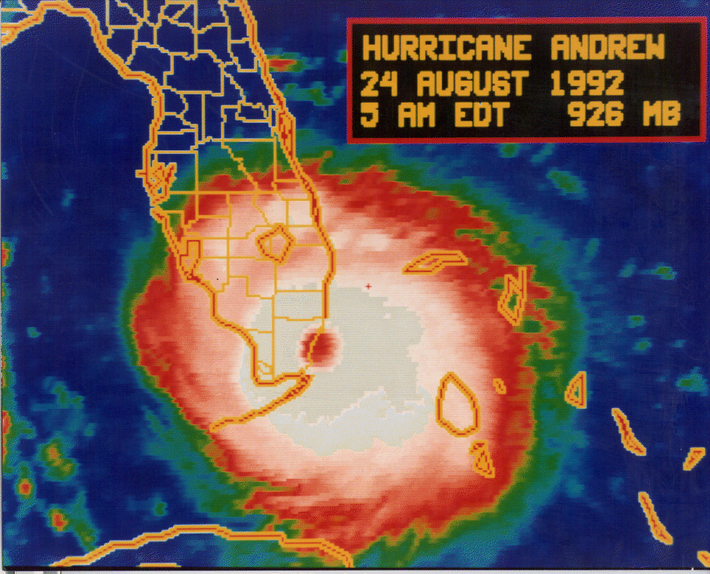
Here is the graphical archive for all 5 day forecasts of Irma: https://www.nhc.noaa.gov/archive/2017/IRMA_graphics.php?prod...
Now note the image that the article depicts for Hurricane Irma with this text: "These misunderstandings have real-world consequences. As Hurricane Irma approached Florida’s east coast in 2017, people near the cone’s center began preparing and even evacuating."
The image and the graphical archive do not correlate. Where did the author get this image from? The actual NHC cone covers the entire width of Florida (apart from maybe the smallest western tip of the keys) for days before the storm arrives. Its actually pretty accurate.
IMO, this article and its poor visualizations is part of the problem.